Geographic profile of Iran
Iran with an area of 1,640,195 square kilometers in the southern half of the northern temperate zone between 03, 25, and 47, 39, north latitude from the equator and 14, 44 and 20, 63 degrees east longitude from half Terrain is Greenwich. About 90% of the territory is located in the Iranian plateau. The land of Iran is generally mountainous and semi-arid, with an average elevation of more than 1200 meters above sea level. More than half of the country’s land is mountains and heights, a quarter of them are plains and less than a quarter of it is also cultivated land. The lowest internal point with a height of 56 meters in the Lut hole and its highest peak is Damavand with a height of 5610 meters in the middle of the Alborz mountain range. On the southern side of the Caspian Sea, the height of the land is 28 meters below the sea level.
Iran is in the temperate region of the Middle East on the planet in an equatorial region. Geographically away from large seas, especially air currents, has caused Iran’s weather to dry and dry, but due to its vast expanse and the presence of various natural events, such as high altitudes in the north and west, and large distances, such as the central plains Inside the plateau and moreover, the proximity of the Caspian Sea to the Persian Gulf and the Indian Ocean, each of which makes a separate climate, Iran has diverse climates.
Iran is a high plateau, close to the vast plains of Asia, with an average altitude of about 1200 meters above sea level. The layers of altitudes and heights, some of which are 4,000 meters tall, and the presence of the northern and southern seas that are far from the central area, especially the mountains around Iran, have made this country one of the rare countries in the world that you can see all weather types in it.
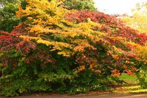
The height of the mountains of Iran is so high that it prevents the influence of wet waves of the Caspian Sea, the Mediterranean and the Persian Gulf in the interior of Iran. For this reason, the outer slopes of these mountains have a humid climate and its interior slopes are dry. On the southern coast of the Caspian Sea, the temperate climate and its rainfall, especially in the west coast of Guilan, are more than other parts.
Three types of weather can be identified in Iran.
-Desert and semi-desert climate: The vast parts of the inner land and southern sides of Iran have this type of water and air. The features of this type of weather have a dry, long period of warmth that sometimes spans over seven months of the year. Annual rainfall varies between 30 and 25 mm.
-Mountainous weather: It is divided into two types of mountainous climate and temperate mountainous climate.
Cold mountainous weather that covers about 40,000 square kilometers of Iranian soil. The annual rainfall in these areas is more than 500 mm.
-Moderate mountainous climate, which covers about 300,000 square kilometers of Iranian soil, and its annual rainfall varies from 250 mm to 600 mm.
Caspian Sea: A narrow, narrow area between the Caspian Sea and the Alborz mountain range, with an annual precipitation of 600 to 2000 mm.
Map of Iran’s climatic regions The variety of climate in Iran is caused by overlapping factors, the most important of which is the expansion of the latitudinal, mountainous stretches and heavier changes in the vast expanses of the country, and finally the position of the land relative to the adjacent and remote rivers.